It is extraordinary!
Lake Syskiyou
Ours is a gated community
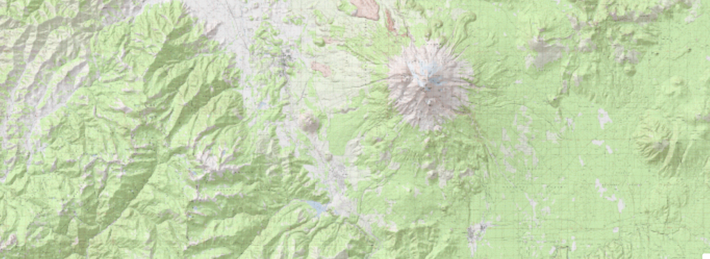
When snowfall is heavy, the County sometimes locks the gate that crosses Castle Lake Road three miles down hill from us. On a fair day, when that gate is open you can coast three more miles before you get to a flat spot, Lake Siskiyou.

Box Canyon
That's Box Canyon
If you make a right turn at the bottom of Castle Lake Road and head towards The City of Mount Shasta, you'll soon cross the Box Canyon Dam where on your left is the reservoir we call Lake Siskiyou and on your right, the Box Canyon.
This is the origin of the South Fork of the Sacramento River
What doesn't get captured for municipal or commercial purposes can make its way to the San Fransisco Bay.
Uphill from our Camp are alpine jewels.
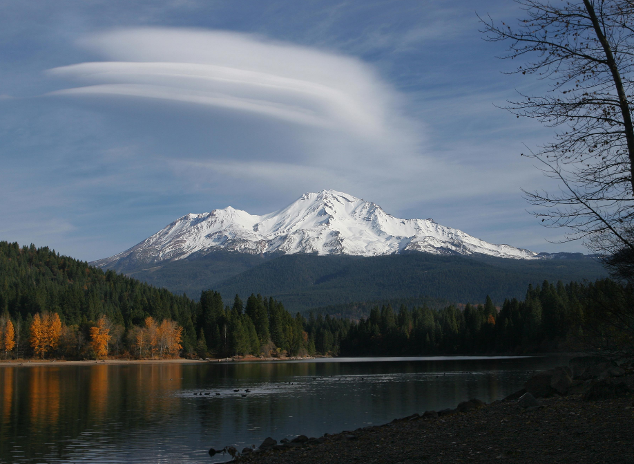
Two miles uphill from our Camp is a cul-de-sac that sits beside Castle Lake. This lake, a tarn of glacial water nearly surrounded by mountains, a geological formation known as a cirque is the most studied of its type in the world. On a bright day, if you hear someone remark about the Cirque du Soliel, you can bet it is a droll limnologist.

Castle Lake
Castle Lake TRAIL

The Castle Lake Trail starts at the parking lot at the end of our road and is nearly 6 miles long. It is a moderate to difficult trail that rewards with spectacular scenery all along the route. The first mile gets you to the top of Castle Lake's eastern head wall where there is a side trail to Heart Lake. This is a wonderful destination for a two hour hike. Continuing on Castle Lake Trail you soon cross the north side of Little Castle Lake, the origin of Ney Springs Creek. The last three miles of the trail feature three peaks, the eastern most being Mount Bradley which looms over Dunsmuir.
Castle Lake
The photographer is standing above Castle Lake's granite headwall and is looking north to Mount Shasta. The trail head is in the wooded area on the northwest side of the lake. The trail soon crosses Castle Lake Creek and turns to the east where it climbs through the forest to the open alpine where several lakes can be found.

Little Castle Lake
Little Castle Lake is aptly named. It is a little version of Castle Lake both having impressive granite headwalls.
Heart Lake
Just a mile from the parking lot is Heart Lake. To get to Heart Lake you have to take a short spur off the main trail. This hike, to Heart Lake and back is usually rated as of moderate difficulty.

Dunsmuir
This view of Dunsmuir is from the top of Mount Bradley, east end of Castle Lake Trail. A full day should be allowed for this 12 mile round trip that is usually rated as either moderate or difficult.

Castle Crags
Along the way you can see the Castle Crags across the valley to the south. Not that far away but getting there from here is more aptly mountaineering that hiking.
She dwelleth and abideth on the rock, upon the crag of the rock, and the strong place.
Job 39:28